a) Static map charts
b) Maps with geocoding
Static map charts
1. Select Country dimension in Invoice cube
Make sure you are using ISO 3166-1 alpha-2 code (2 letter code) as customer country code in HansaWorld. These codes will then be converted to full country names by flex.bi application.
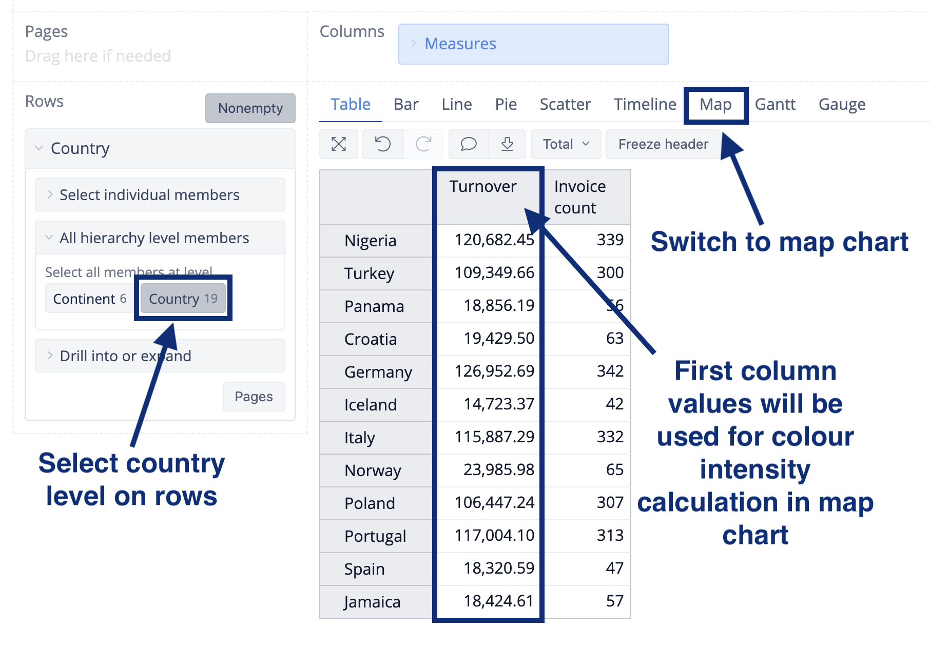
At first select Country dimension in HansaWorld Invoice cube and select country level on rows and necessary measures on columns (the first column will be used to calculate the color of the region on a map).
2. Select the corresponding map
Go to Map tab and select the corresponding map (world map, Europe map or particular country map).
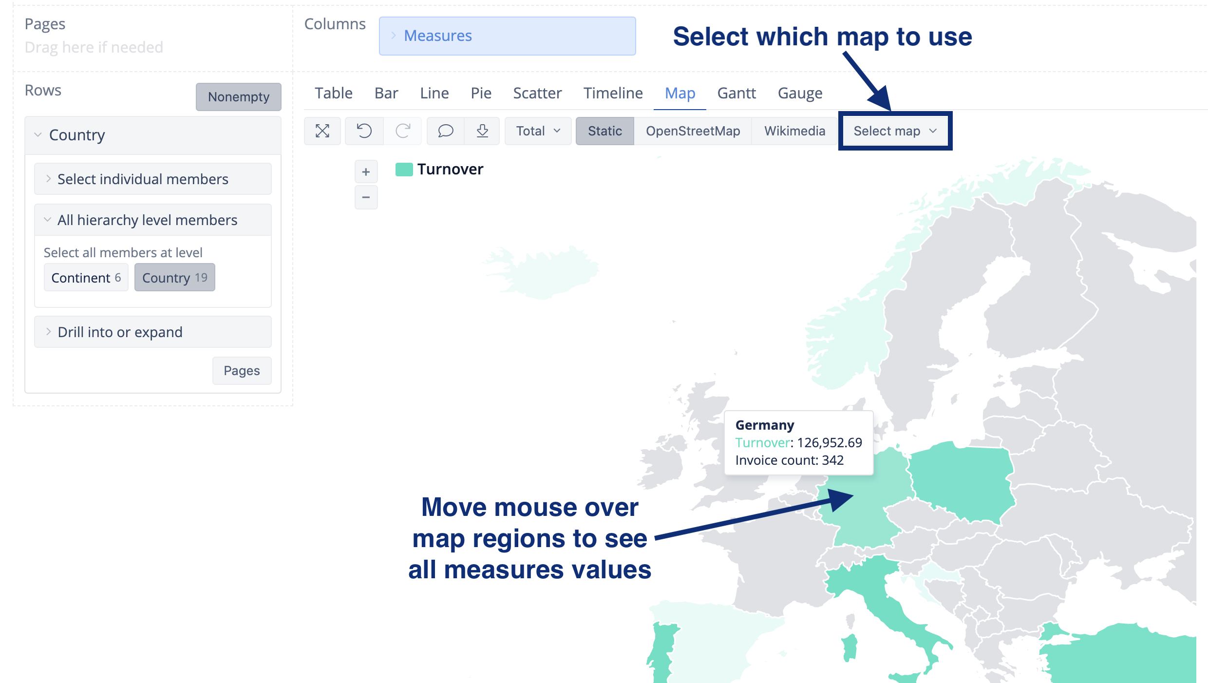
The countries are mapped with the ISO two letter codes. As well the country names you can see when hovering over the country in the map will be recognized. Additional aliases are added to recognize USA, US and United States.
3. Import additional data
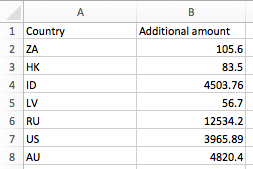
If you have additional data (outside HansaWorld) you want to import to country dimension, you can do it from excel or csv file.
Make sure you are using ISO two letter codes to identify the country.
Maps with geocoding
You can use our Geocoding functionality, that converts Customer and Supplier address data into precise geographic coordinates that can be shown on a map together with other data of your choice. You can learn more about this here: How To Use Geocoding with TomTom integration.